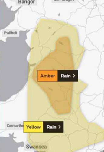
People don’t care about the weather, they care about how the weather affects what they want to do. Awareness of this has driven a move towards ‘impact based’ forecasts, led by the UN through the Sendai Framework and the World Meteorological Organisation (WMO).
This approach is already very familiar to anyone that watches TV weather broadcasts, which now not only contain ‘traffic light’ style warnings for wind and rain etc but also secondary warnings for things as diverse as air pollution, pollen/hay fever, floods, transport disruption and power supply disruption.
There are also unseen ways in which these forecasts effect our lives. For example in the UK, the posture of the National Health Service is determined by forecasts of ‘Early Winter Deaths’ derived from temperature forecasts. Similar approaches are apparent across the world, with national weather services replacing traditional weather bulletins with impact based forecasts. These seek to translate meteorological and hydrological hazards into risk-based, sector and location-specific impacts and the development of responses to mitigate those impacts. The United States National Weather Service’s programme and the European warning system are prime examples.

The UK’s shipping forecast celebrated its 150th anniversary in 2017 and, so far, the maritime world has remained virtually untouched by these developments. However this is going to change, with amongst others, Canada, Brazil and Australia developing plans to launch impact based marine forecasts and introducing this topic at last year’s Joint WMO-IOC Technical Commission for Oceanography and Marine Meteorology symposium.
The most dramatic change will come through the replacement of the current text based METAREA forecasts with ECDIS overlays to support SOLAS Chapter 6. We can expect to see a gradual introduction of SOLAS weather products onto ECDIS over the next 5 years with the development of the S-101 data format to replace the more limited S-57.

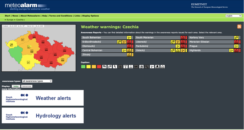
These enhancements will enable competent authorities (METAREA coordinators) to move away from generic area forecasts and warnings to produce digital graphical forecasts which are accurate in time and space and even tailored to individual vessels. This output may resemble The EU Meteo Alarm System.
Without sufficient preparation, this could be a difficult transition for shipping and meteorology. Impact-based forecasting, at its simplest, is the translation of hazard jargon into clear information about the likely impact. However, this will require an immense amount of specialist and ship specific knowledge. It could, in the worst case, be dangerous or at the least very misleading. Just consider for example, instead of receiving a “forecast of 40 knot winds” receiving an “AMBER forecast for wind” without consideration of your size, course, speed, operational situation etc.
The translation of weather into ship impacts has been the value add provided by commercial weather providers so they should pay careful attention to these developments. National providers such as NOAA moving into impact based forecasting will challenge commercial providers to develop new, perhaps more ship specific, solutions to add value.
No doubt more will follow on this topic!
Stay connected and safe.