In previous posts we have dealt with many aspects of the carbon reduction challenge facing shipping (and also everyone else on Planet A!). We have discussed the reduction targets and some of the associated developments such as market based measures, measurement, reporting and future fuel choices. Some of these are already the subject of regulation or regulation is expected. Regulation is in some respects “easy” even if we hear heated debate about it because without corresponding enforcement it is meaningless. In this post we will discuss how remote sensing can add to maritime domain awareness and monitor emissions, supporting efforts to achieve challenging reduction targets.
First a recap, there are currently two reporting schemes to measure vessel emissions. Both employ a bottom up approach with the EC Monitoring, Reporting and Verification (MRV) and IMO Data Collection System (DCS) both requiring ships to report their consumption. Consumption can be measured by one of four methods: bunker delivery notes (BDN), bunker fuel tank monitoring on-board, flow meters or by sensors located to directly measure CO2 emissions in the plume. All four methods are organic to the ship and are subject to various issues including tampering and inaccuracies. As regulatory enforcement is the main driver for ship emissions monitoring it is likely that a complementary top down approach may also be developed.
Remote sensing
There are technologies that could assist with remote monitoring of vessels, though none are mature. Chalmers University of Technology in Sweden have developed and put into use a passive optical measurement system to measure ratio of SO₂ to CO₂ in the ship’s exhaust plume. Sensors mounted on aircraft, drones or under bridges, as they are in Denmark and Germany, can directly measure the emissions in ships’ plumes. Such schemes are already established in several ports in Europe and Hong Kong.
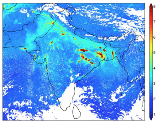
Satellites are also contributing to monitoring but until recently have been limited because of low resolution. The TROPOspheric Monitoring Instrument (TROPOMI) on the European Space Agency’s (ESA) Sentinel 5 satellite has a resolution of around 3.5 km x 7.0 km and has already proven its ability to measure the amount of NOx in shipping lanes.
Now the EU has tasked ESA to design a satellite specifically for the macro-monitoring of CO₂. It was recently announced that OHB System, a German satellite systems specialist, has been awarded the first two satellites which will form the foundations of the agency’s Copernicus Carbon Dioxide Monitoring Mission (CO2M). Thales Alenia Space will supply a near-infrared and shortwave-infrared spectrometer that will measure emissions of CO₂. The expectation is that the new, carbon-tracking sensors will be in orbit sometime in the 2020s.
The future
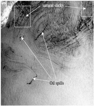
The EU has had an operational environmental monitoring service since 2007 when CleanSeaNet was created by EMSA. CleanSeaNet uses space based remote sensing (Synthetic Aperture Radar (SAR) and Electro Optical sensors on ENVISAT, RADARSAT 1 and 2, and SENTINEL-1 to identify and report possible oil spills, pollution alerts and related information to the operational maritime administrations within 30 minutes. When a recent or ongoing spill is detected with a potential source connected to it or in its vicinity the relevant authorities are informed immediately. CleanSeaNet combines oil spill detection with vessel information from SafeSeaNet and backtracking models from national and regional centres to help to identify the source of pollution.
A comparable approach to monitoring emissions may soon be available. It may not be a Government led initiative, however. There are commercial initiatives in development, for instance Carbon Space which plans to use multiple space based and terrestrial sources to reliably estimate the carbon footprint of corporations in order to satisfy shareholder and commercial pressure to prove they are responsible global citizens.
Space based technology already plays a significant part in our lives and it is almost certainly going to be increasingly deployed in the enforcement framework for shipping and other industries. Watch this space!
Stay connected and safe.
