October and May mark the transitional monsoon seasons across the North Indian Ocean and the Bay of Bengal and Arabian Sea. During this transition season weaker deep layer wind shear prevails resulting in an upturn in likely tropical cyclogenesis. Right on cue, a recent system, named by RSMC (New Delhi) as Cyclonic Storm Gulab, formed on 24th September in the northeast Bay of Bengal. Cyclonic Storm Gulab moved due westward before making landfall in Eastern India as a tropical storm on 26th September where it brought gales, torrential rain and local flooding over North East India before disintegrating over central India.
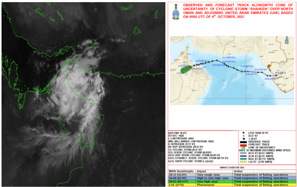
Fig 1. Left: Visible Satellite of Severe Cyclonic Storm Shaheen from India Meteorological Department and Right: historic / forecast track cone of uncertainty
On 28-29th September, the remnants of Gulab continued to track westward across India. However, given the low vertical wind shear over the Indian subcontinent and deep layer, low and mid level moisture over the region, the remnant low was able to avoid dissipating completely. So, by 30th September it had completely crossed India and unusually re-emerged over the northeast Arabian Sea where warm sea surface temperatures (29-31 Deg C) along its path helped intensify the system’s inner core structure, with the system regaining cyclonic storm intensity by 1st October. The cyclone (ex Gulab) was renamed to Shaheen by the Indian Meteorological Department and it continued to move west into the Gulf of Oman slowly strengthening to a Severe Cyclonic Storm (equivalent to Cat 1) through landfall in North Oman on 3rd October.
Severe Cyclonic Storm Shaheen made history as the first and only tropical cyclone to make landfall on the Northern coast of Oman between Muscat and the important port of Fujairah. The storm also becomes the only Arabian Sea Cyclone to enter the Gulf of Oman from the east, with all other storms generally showing a southerly track before making landfall in Oman as indicated at Fig 2.
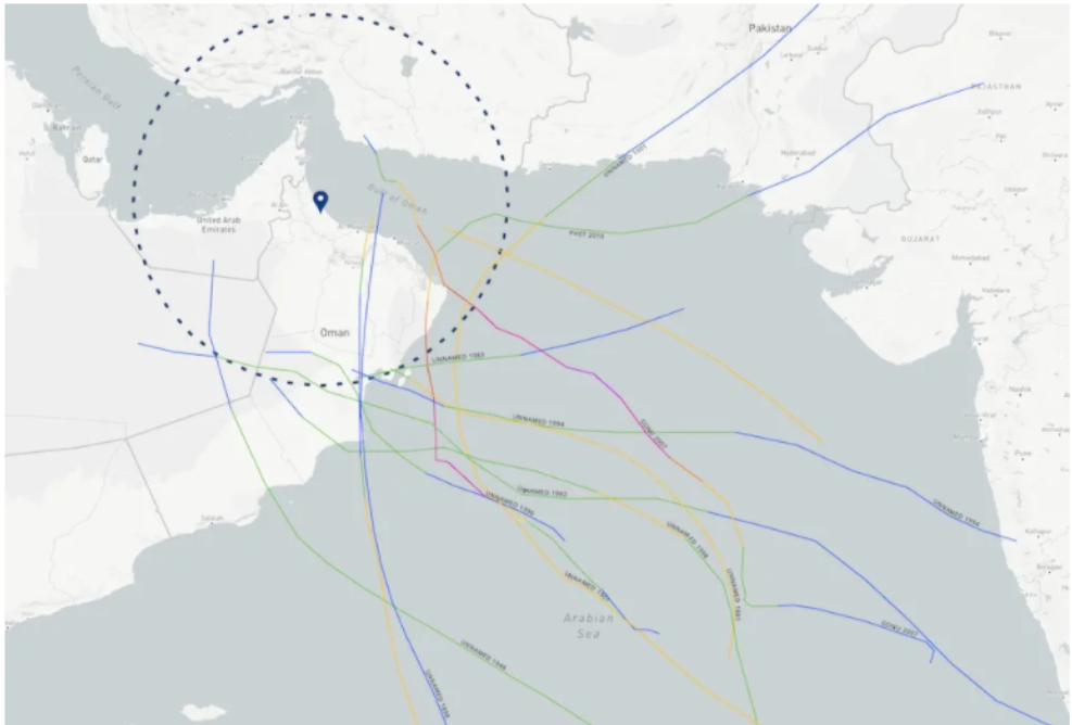
Fig 2. Historic Track Density of Tropical Cyclones in the Arabian Sea and the projected location of TC Shaheen Landfall for 3rd October 2021 (image from NOAA Hurricane History).
Every tropical season is unique and in terms of ship routing Shaheen pretty much closed off the Gulf of Oman for a short period. This resulted in some pretty rare routing alterations in the region with our clients being advised to either stay adrift near the Strait Of Hormuz, or to reduce speed if approaching the Gulf of Oman or to slow/drift to the southeast of Shaheem’s track in the Arabian Sea until the system made landfall.
Stay connected and stay safe.