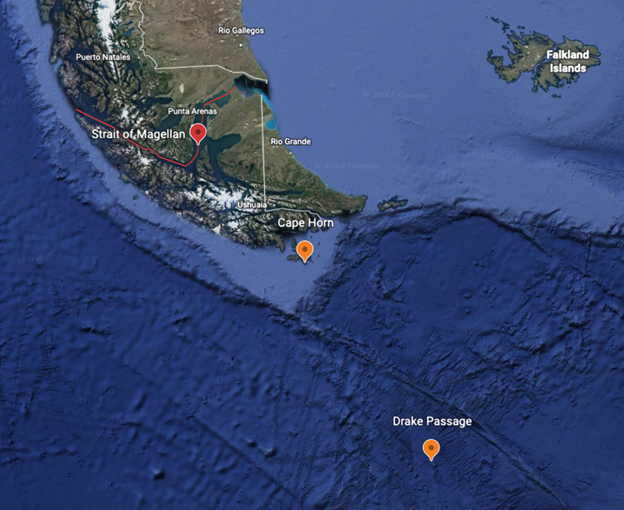
The continent of South America acts as a 4700 mile land barrier, dividing the Atlantic Ocean and the eastern Pacific Ocean. When considering commercial routing between the two oceans, there are three options: Panama Canal, Magellan Strait, and the Drake Passage. This blog will focus on Magellan Strait and Drake Passage as their close proximity to one another makes the marine routing decision between the two a somewhat frequent occurrence.
Time and Money
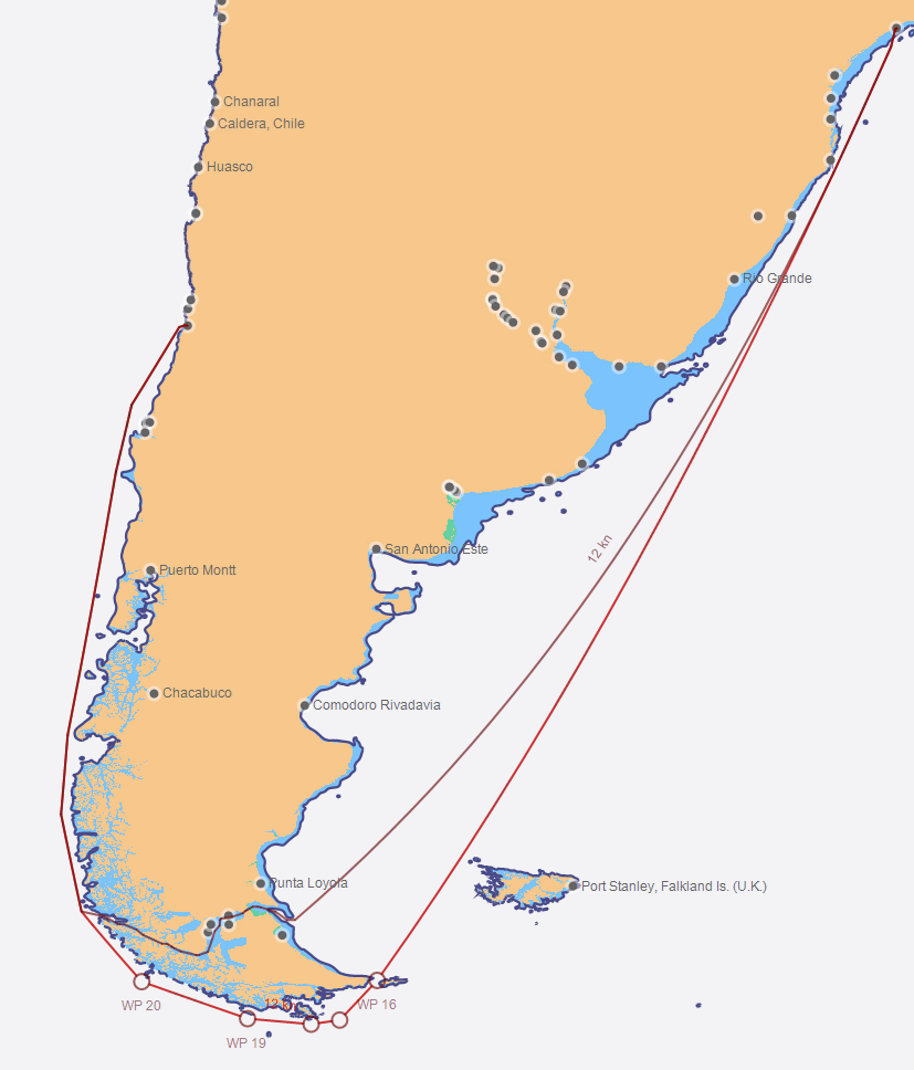
Transiting via Magellan Strait can save 171nm distance when directly compared to a route via Drake Passage; but if Magellan Strait is a shorter route, why would a vessel route via Drake Passage? Well, Magellan Strait gets as narrow as 1.1nm across and has unique routing challenges such as strong tidal currents, small islands, fog and icing. These challenges require a vessel to pick up pilots for the 310nm transit, which, depending on the size of the vessel, can quickly exceed $18,000 USD. This additional cost is a major reason to consider Drake Passage. However, factoring in the weather, some seasons are more favorable for this transit than others.
What’s the Weather?
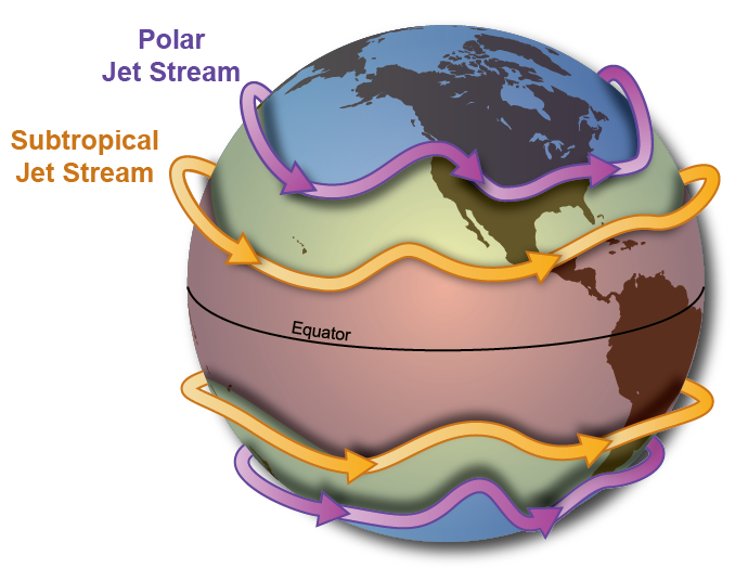
The southern ocean gale track is intense! The National Ocean Service refers to this area as the Furious Fifties, referencing gales which persist between 50-60 degrees latitude. In the southern hemisphere, the storm track moves west to east and encounters much less land than its counterpart in the northern hemisphere. As a result, the storm track is able to circulate clockwise around Antarctica unhindered. Where is Cape Horn, the northern point of Drake Passage? 56 degrees South latitude.
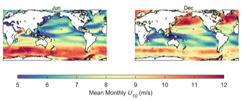
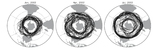
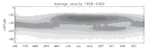
During the summer seasons in the southern hemisphere (Dec, Jan, Feb), we can observe a weakening and poleward consolidation of the subtropical jetstream. As a result, low pressure systems trend weaker on average, allowing more frequent opportunities to safely transit via Drake passage without delay. However, as we enter the transition to the Austral winter months (Jun, Jul, Aug), we can climatologically observe the subtropical jetstream strengthening and separating equatorward. This relocation and associated strengthening of the jet yields more frequent periods where swells and gales exceed conditions for safe navigation in Drake Passage. A graphical representation of this pattern can be seen in the images below.
With the possibility of delays becoming increasingly likely during the winter months, the added cost associated with delays rounding Cape Horn can outweigh the cost of pilotage through Magellan Strait.
Vessel Type and Size
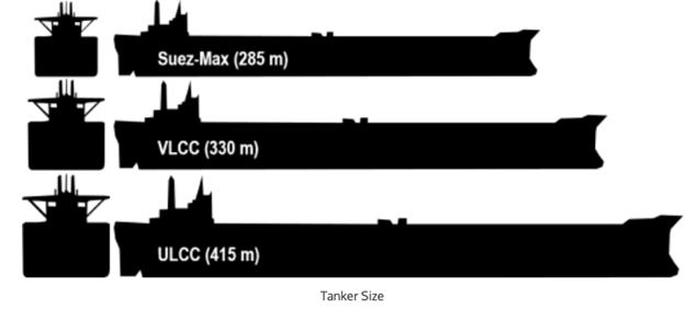
Not all vessels have the option to transit via Magellan Strait. The strait has a draft limitation of 21.3 meters, excluding today’s largest vessels from transiting the strait. Suezmax, VLCC, and ULCC tankers are excluded from the list of vessels with the option to transit via Magellan Strait.
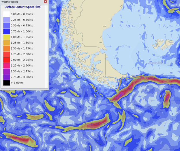
Currents
Another factor to consider when deciding between Magellan Strait and Drake passage is the direction of the Antarctic Circumpolar Current, as well as the active Southern Ocean gale/storm track. Vessels transiting from the Atlantic to the Pacific via Drake passage would likely encounter periods of adverse current and head wind/waves, resulting in higher engine slip. Conversely, vessels transiting from Pacific to Atlantic may experience some current assistance.
Summary
Vessel owners and operators must weigh numerous factors when deciding between Magellan Strait and Drake Passage. At Fleetweather, our team of Marine Routers continuously monitor the weather conditions which may affect this decision throughout the year, and work to keep all relevant parties advised as needed, so they may make a better informed decision.
Stay Connected and Safe.