A meteotsunami, also called meteorological tsunami, is a relatively new concept akin to rogue or freak waves. With tsunami in the name you would be forgiven if you think they are caused by seismic (e.g. earthquake) activity. They are tsunami-like in character but are generated when rapid changes in barometric pressure (typically between 5-10 hPA over a 10 minute period) create water-level fluctuations. Their formation requires the combination of a meteorological disturbance such as a fast moving squall line, thunderstorm or frontal trough that either generates a wave front and/or a resonance is set up with a deep water wave moving at a similar speed. These waves can then be amplified by shoaling in semi-enclosed water bodies like harbours, inlets and bays.
Most meteotsunamis go unnoticed either in open water or lost as small waves within normal ocean noise. However, major ones can reach 5-6m in height which is not as catastrophic as major seismic tsunamis but nevertheless they can cause damage. These destructive events are rare and occur only when there is a coincidence of several crucial factors taking place at the same time; such as a local weather system able to set up a resonance, a continental shelf and slope that allows the wave to move to shallower water, and a topography and geometry of the coastline (harbours, bays, inlets etc) that together amplify the wave.
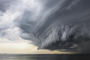
A storm front over the sea
Meteotsunamis are a global phenomenon and local hot spots for their occurrence have local names, such as Zeebar (N Sea), Seebär (Baltic), Rissaga (Spain), Milghuba (Malta), Marrobbio (Italy), Abiki (Japan) and Sciga in Croatia (Adriatic Sea). One recent occurrence hit the worlds longest beach – Praia de Cassino Beach, Brazil on 14 March earlier this year was captured in this Youtube clip. This event was caused by a fast-moving squally cold front sweeping along the coast of Brazil, where strong convective downdrafts caused a sharp increase in surface pressure so creating an oscillation that moved inshore.
More recent research has shown that meteotsunamis are more common than previously thought and represent a significant challenge to predict. There is also strong evidence that some past events may have been mistaken for other types of wind-driven and pressure related events such as storm surges or seiches. Identifying meteotsunamis can be a challenge because their shared characteristics. Recent research in Australia has identified some 214 meteotsunami events occurred over the period 2009-2014.
A storm surge is a change in sea level that is caused by either strong winds which push the seawater towards the coast, causing it to pile up and/or there is also low pressure which raises the sea level. This is more synonymous with a tropical cyclone, where at the centre the low pressure “pulls” the water level up by about 1cm for every 1 hPA change in pressure.
Seiches are standing waves with longer periods of water-level oscillations (typically exceeding three hours or more), whereas meteotsunamis are progressive waves limited to the tsunami frequency band of wave periods (2 minutes to 2 hours). While seiches are usually limited to partially or fully enclosed basins or lakes, meteotsunamis are more prevalent in more open coastlines.
Stay connected and safe.