While weather presents a year round challenge for safe navigation on the world’s oceans, sea ice seasonally presents its own set of navigational challenges. The impacts to ship routing and navigation can extend well into the warmer months of spring and early summer. In particular, icebergs off the east coast of Newfoundland and Labrador are a prevalent issue for vessels trans-Atlantic routing between North America and Europe.
The extent to which icebergs impact heavily travelled shipping lanes between North America and Europe can vary from year to year. The image below shows the latest iceberg analysis for the area east of the Canadian Maritimes at the time of this writing. While the number of icebergs is low south of 47N latitude, it only takes one iceberg to become a navigational hazard!
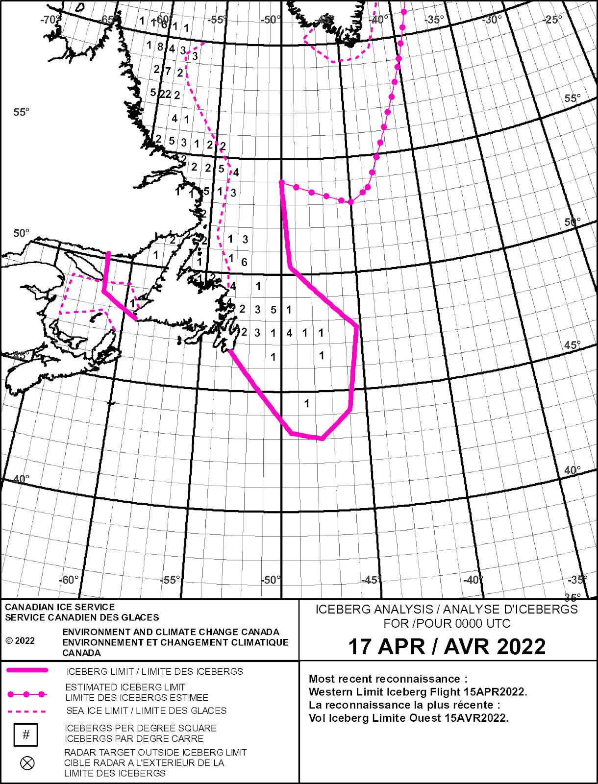
Figure 1: Latest Iceberg Analysis as of 17 April 2022 (Source: Canadian Ice Service)
How does this compare with the last few years for mid-April? While both 2019 and 2020 had a wider extent of iceberg-infested waters off Newfoundland (in both coverage and quantity), 2021 was greatly reduced in the number and areal extent of icebergs, with coverage remaining more confined to coastal waters of Newfoundland and Labrador.
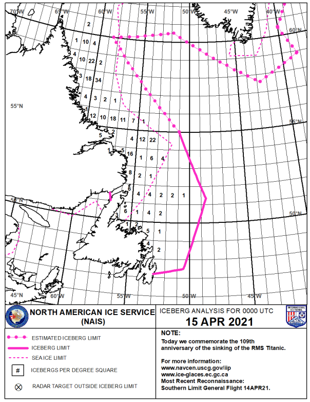
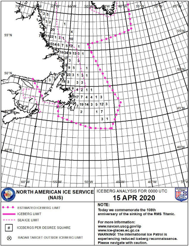
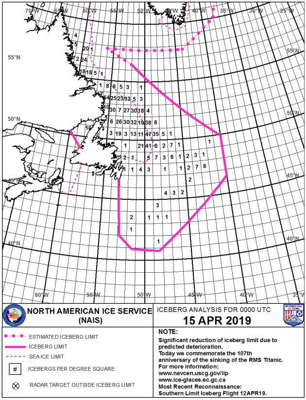
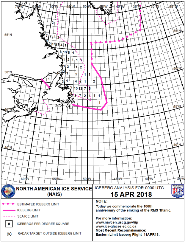
Figures 2,3,4,5: Iceberg Analysis from 15 April for years 2018-2021 (Source: North American Ice Service)
While the variability of iceberg coverage over the last few years may seem quite large, historically there has been quite a wide range in the number of icebergs off Eastern Canada that encroach the main shipping lanes south of 48N from year to year, as shown in Figure 6.
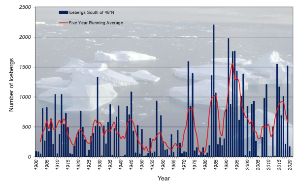
Figure 6: Number of icebergs south of 48N latitude per year along with the five year running average drawn in red (Source: North American Ice Service)
Predicting bergs
So what can we anticipate in the upcoming weeks? While iceberg movement is partially dictated by ocean currents (such as the equatorward flowing Labrador current off Eastern Canada), forecasters also look to the North Atlantic Oscillation (NAO), which is an index based on pressure differences between the Azores high and Icelandic low, and provides a general sense of the overall weather pattern. A positive NAO index is indicative of stronger mid and upper level ridging across eastern North America with mid and upper level troughing across Greenland (yielding more consistent northwesterly winds/seas off Labrador, aiding in movement of icebergs southward towards the shipping lanes), while a negative NAO index provides the opposite. In the latest forecast shown in Figure 7 the current positive phase of the NAO is expected to turn negative in the coming days, which will likely result in more persistent onshore winds along the Labrador coast, bringing relatively warmer maritime air to the region. These conditions would be less favorable to a continued southward push of icebergs into the shipping lanes.

Figure 7: Latest observed and predicted NAO Index (Source: NOAA)
Stay connected and safe.