Just as we enter the North Atlantic Hurricane season, the National Hurricane Center (NHC) has classified its first Potential Tropical Cyclone of the season over the Northern coast of the Yucatan Peninsula, named Potential Tropical Cyclone One (Invest 01L). Forecast Advisories for Invest 01L began 02nd June at 21z, with the broad Low Pressure center over the Northeasternmost coast of the Yucatan Peninsula.
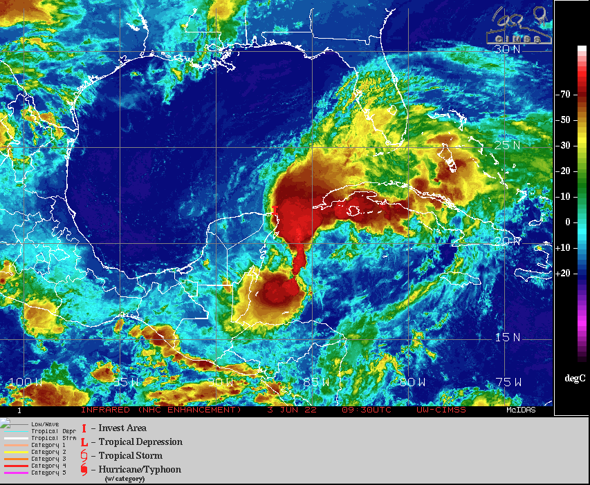
03 June 0930z satellite image courtesy of CIMSS
Current satellite imagery depicts a broad low pressure disturbance with associated convection under high vertical wind shear; however, tropical storm force winds are already observed near the center. Latest forecast from RSMC NHC is predicting Invest 01L to develop into a tropical storm in the next 12-24hrs as it tracks to the Northeast over very warm sea surface temperatures across the southeastern Gulf of Mexico.
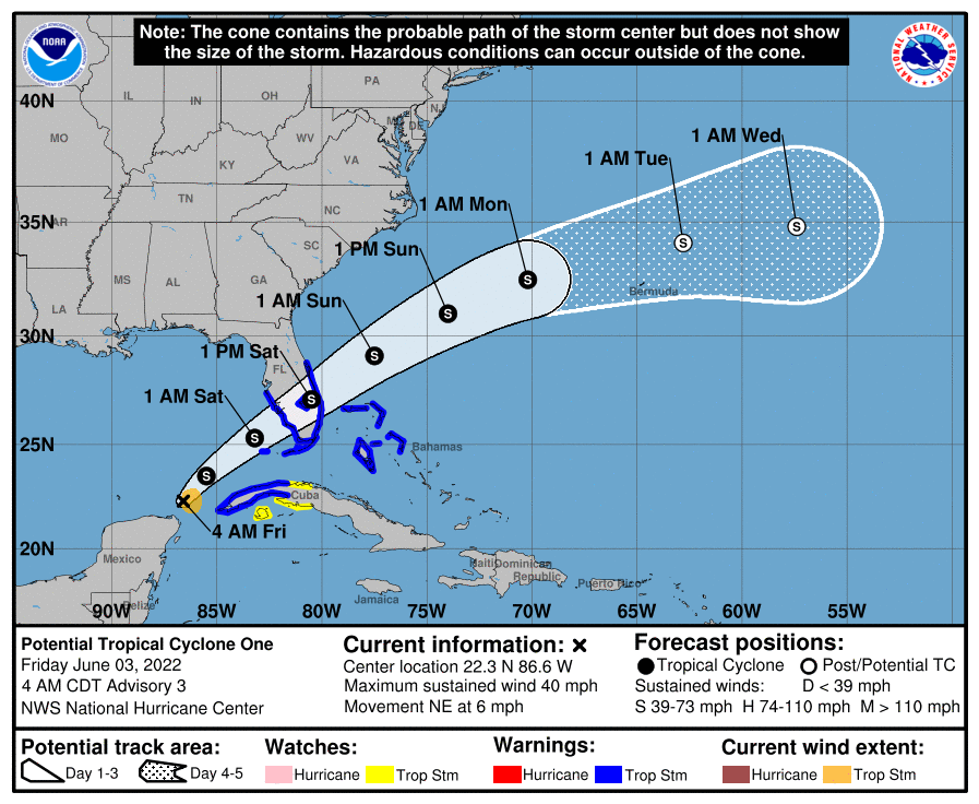
Above Image courtesy of the National Hurricane Center
Latest computer data is currently in high agreement of a North to Northeastern track in coming days with the system passing over Florida Peninsula by Saturday afternoon. It is the development of this system that remains mostly unknown, especially since the unfavourable environment over the Gulf of Mexico; however, it is possible for further development once the system makes it over the open Atlantic at the beginning of next week as it interacts with mid-latitude trough.
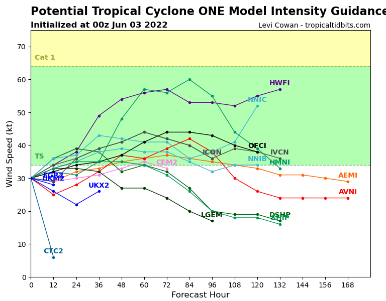
Invest 01L Model Intensity courtesy of tropicaltidbits.com
Who will be affected?
As mentioned earlier, there is high confidence amongst the models regarding Invest 01L’s track in the next 48-72hrs. Tropical Storm conditions are likely in the shipping lanes of the far southeast Gulf of Mexico into Florida Strait through tomorrow. Also, Tropical Storm watches are currently active for Southern Florida, Florida Keys, and Western Cuba, shown in the Image above.
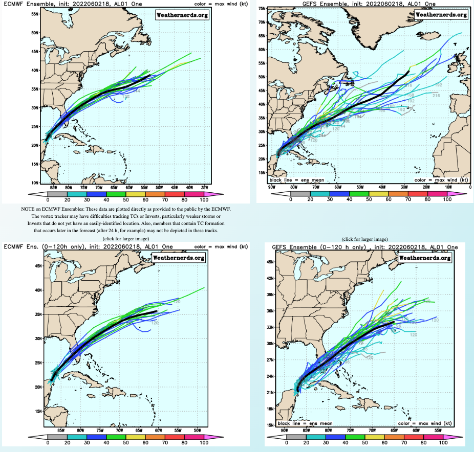
ECWMF and GFS Ensembles Image courtesy of weathernerds.org
Any vessel calling ports from Western Florida to Southern Mexico may expect route adjustments in coming days.
To the east of Florida north of Bahamas until Bermuda, routes will also be affected however the system is expected to be fast moving into early next week, accelerating and losing any tropical characteristics by then, so delays will then be limited. See my colleague Kyle Gollegly’s latest video update for more information.
Stay connected and safe.