Co-authored by Kyle Gollegly RMet, FRMetS who is a Senior Marine Router on our Atlantic Orcas watch.
The Indian monsoon can be broken down into two seasons: the drier Northeast monsoon which encompasses the winter months, and the wetter Southwest monsoon during the summer months. The transition periods between these seasons (typically mid-late Spring and Autumn) coincide with the peak times for tropical cyclone development across the Arabian Sea and Bay of Bengal. While tropical cyclones can form at any point during the year, some reasons for these times representing climatological maxima for the potential of development include reduced wind shear (due to weaker/non-existent monsoonal flow across the basin) when combined with sufficiently warm sea surface temperatures (in excess of 26.5 degrees Celsius) as well as favourable climate teleconnections (such as the Madden-Julian Oscillation (MJO)).
As we edge closer to the summer season these favourable conditions across the southeastern Arabian Sea have caused the first tropical cyclone of the year to form near the Lakshadweep Islands off the southwest coast of India, the Joint Typhoon Warning Centre (JTWC) is tracking Tropical Cyclone 01A (named as Tauktae by RSMC New Delhi). Conditions are expected to remain favourable for steady intensification over the next 2-3 days, and the cyclone is expected to remain intense through landfall. There remains some uncertainty amongst current deterministic forecast data as to exactly where landfall will occur, with present indications suggesting this to occur along either the southeast coast of Pakistan or northwest coast of India. Of note, a hurricane strength cyclone impacting Pakistan is very rare event.
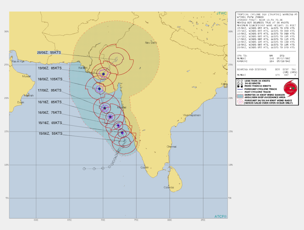
Figure 1: Latest forecast track from the Joint Typhoon Warning Center (JTWC)
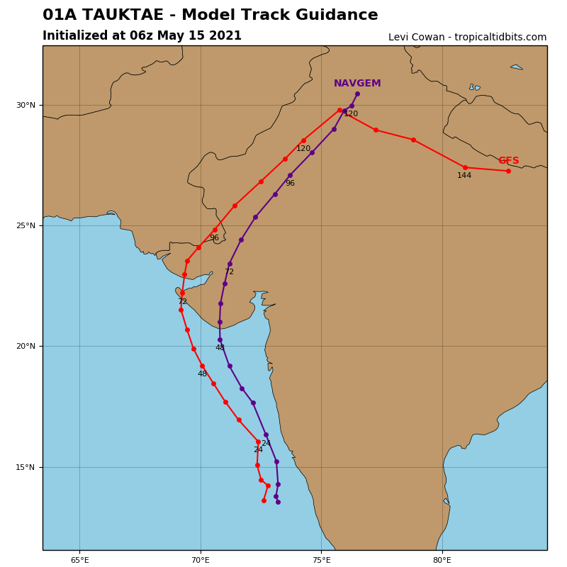
Figure 2: Present deterministic model tracks for 01A valid 14 May 1200 UTC (Source: tropicaltidbits.com)
Tauktae will present a threat to shipping, impacting routes between the Persian Gulf and Gulf of Oman region, Pakistan and the west coast of India to the Far East until the system makes landfall early next week.
Tropical cyclones in the Arabian Sea and Bay of Bengal can also serve as a catalyst for the forthcoming monsoon season to commence, strengthen and increase sea heights. In the wake of TC Tauktae, forecast data shows the development of persistent southwesterly winds across both the Arabian Sea and the Bay of Bengal, which will continue to gradually strengthen over the coming weeks, which will present its own impacts on shipping across this region.
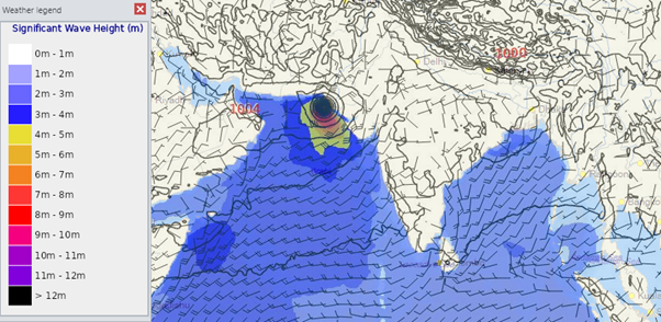
Figure 3: Forecast from 00 UTC GFS model on 15 May 2021 valid 19 May 15 UTC
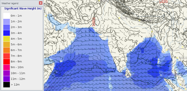
Figure 4: Forecast from 00 UTC GFS model from 15 May 2021 valid 23 May 2021 00 UTC
Summer is truly on the horizon!
Stay connected and safe.