Our watch-keeping ship routers have a lot to watch!
ATLANTIC
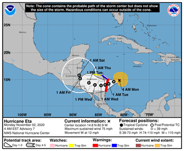
The North Atlantic hurricane season remains on track to set a new all-time record. The 28th named storm of the season, TS Eta (the seventh letter in the Greek alphabet) ties 2020 with 2005 for the most named storms in an Atlantic hurricane season. One of the storms in 2005 was not named because it was discovered in post-season analysis, so this is the first time that Eta has been used in any Atlantic season. As shown in this latest graphic issued by the NHC this morning, TS Eta is moving westerly at 10knts and could become a major hurricane by the time it reaches Nicaragua tomorrow (Tuesday) before moving over Honduras on Wednesday.
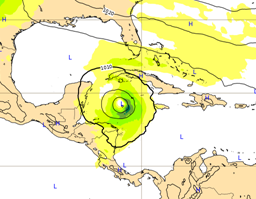
Interestingly, some of the main global models are showing a cyclone over the NW Caribbean later this week and in to next weekend. Here is the European model for 12Z next Sunday (8 Nov) and it is not certain at this time whether this is Eta after re-intensifying or a new system that could form in that area just south of Cuba and even move in to the Gulf of Mexico thereafter. The GFS model shows something similar . So will this be named Theta – the first time the 8th Greek letter will ever have been used?
In any event the Atlantic season still has 4 weeks to go, ending 30 November, there remains every chance that 2020 will surpass 2005…watch this space.
NORTH WEST PACIFIC
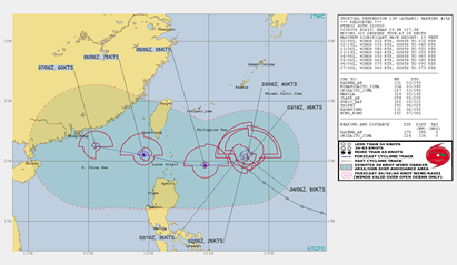
In the NW Pacific so far it has been a below average season in terms of tropical cyclones. There are currently two active systems; Super Typhoon Goni is currently over the South China Sea and reached Cat 5 status prior to going ashore over the Philippines on 01 November, with sustained 1-minute winds of 169 knots and a central pressure of 884mb as reported by the Joint Typhoon Warning Centre (JTWC).
Goni is the strongest tropical storm so far globally in 2020 but interestingly according to the JTWC it was the strongest tropical cyclone to make landfall since records began. However, the Japan Meteorological Agency (JMA), recognised by the World Meteorological Organisation (WMO) as the official agency for issuing Typhoon forecasts in the NW Pacific, indicated that Goni only reached 122 knots sustained 10-minute average winds and a pressure of 905mb. This is quite a difference!
There have been two other Cat 5 storms in 2020; Cyclone Amphan in the North Indian Ocean in May and Cyclone Harold in the SE Pacific in April. Goni is currently tracking west-southwest and is expected to make landfall over southern Vietnam as a tropical storm on 5 Nov.
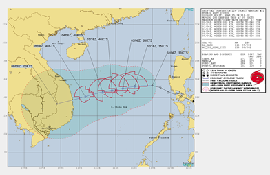
Meanwhile, we also have TD ATSANI which lies just to the north east of the Philippines. It is expected to become quasi-stationary for the next 2-3 days before strengthening and moving west into the Luzon Strait by 6 Nov with winds of up to 75-80knts. Below average season, yes, but still devastating for those impacted.
AUSTRALIA REGION
Finally, looking elsewhere, the El Nino Southern Oscillation (ENSO) has entered a medium to strong La Nina event . This indicates an above average tropical cyclone season for the SW Pacific and Australasia. According to the Australian Bureau of Meteorology (BOM) the long-term average of tropical cyclone numbers across the Australian region, since reliable satellite imagery became available in 1970, is 11 tropical cyclones per season. Interestingly, only once since 2000 have more than 11 tropical cyclones been observed in a season, and guess what, that was also in 2005, when 12 tropical cyclones were recorded. The timing of the first tropical cyclone of a season is often earlier in La Niña years, so instead of an average date around 1 January, mid-December is more likely.
Stay connected and safe.