The hyperactive 2020 Atlantic hurricane season remains on track to set new records. We currently have hurricane Delta which is the 4th tropical named storm of the Greek Alphabet and the 25th of the season. The previous record was held by Gamma which formed on 15th November, 2005. Delta reached tropical storm status in the western Caribbean on Monday 5th October which marks the earliest date that any Atlantic season has produced its 25th tropical storm. Delta has achieved the most intensification over 24 hrs for a named October Atlantic storm since Wilma, 2005. Delta is also the fastest storm to intensify from a tropical depression to Cat 4 in modern Atlantic records. The previous record was Keith, 2000 (in 42 hrs).

The 2005 season went on to reach Zeta (the 6th letter), so the 2020 season is now just 2 storms away (Epsilon and Zeta) from setting a new all time record of 28 tropical storms and use Eta, the 7th Greek letter, for the first time ever. As the 30th November, which traditionally marks the end of the Atlantic hurricane season, is nearly two months away it looks increasingly likely 2020 will set a series of new all time records.
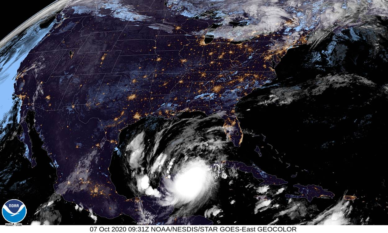
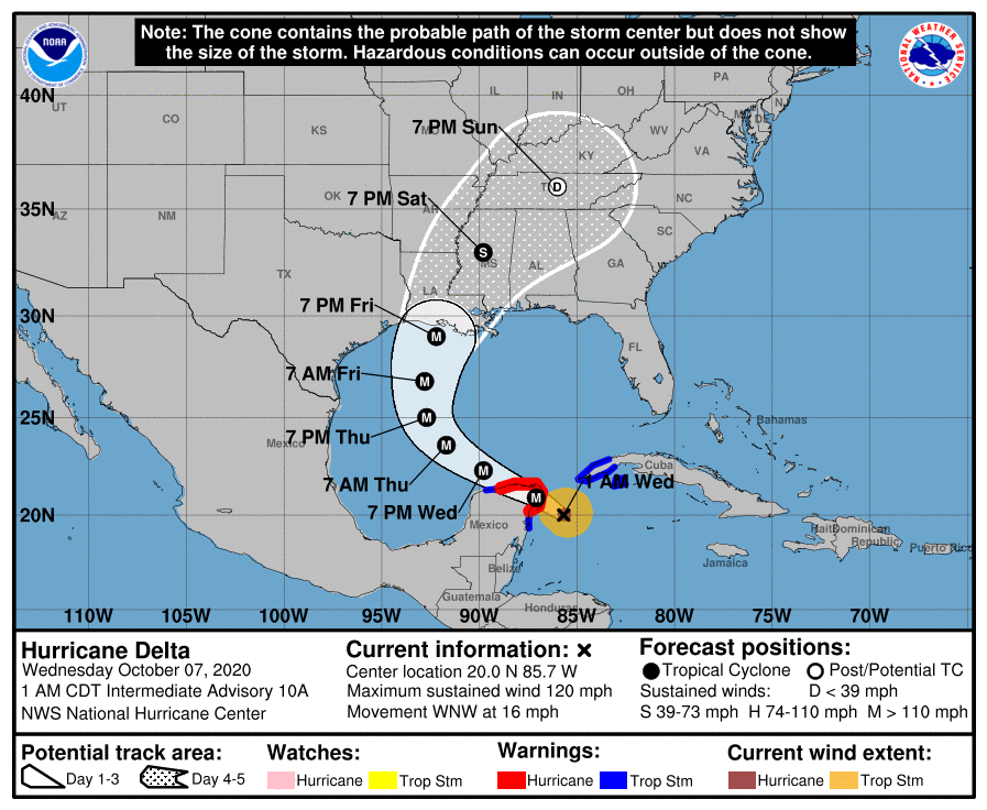
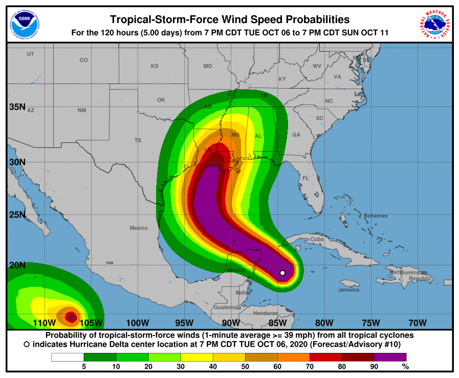
Here are the latest NHC forecast track and wind speed probability graphics for Delta. The 0931Z satellite image shows Delta crossing the eastern Yucatan coast. The system is expected to move northwest at about 15 knots and re-emerge over the Gulf of Mexico later this afternoon. Delta is then expected to re-intensify once over the Gulf of Mexico with most model guidance showing the system reaching Cat 4 status in 36-48 hrs time but to weaken slightly as it approaches the Louisiana coast late Friday. While there is still some uncertainty over the turn northwards between the models there is good agreement that Delta will grow in size as depicted in the wind probabilities graphic. Wind, storm surge, and flooding rains will all be significant threats from Delta along large parts of the Gulf coast.


In looking ahead to the remainder of the season tropical storm formation tends to move away from the Cape Verde region off the west African coast towards the western Caribbean Sea, western Atlantic and the Gulf of Mexico, where waters remain very warm and there is favourable shear. Climatologically this region is prone to rapid intensification late in the season.
Stay connected and safe.