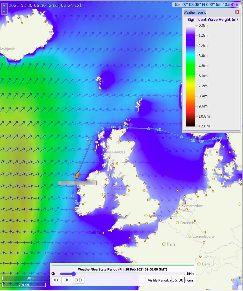
February in the North Atlantic is typically stormy and this winter has been no exception. There has been a succession of single very large storm force lows that have dominated the whole north Atlantic. This has forced trans-Atlantic voyages to generally avoid great circles and route well south via the Azores.
More regional voyages are also impacted and require adjustments to their schedules and/or the use of alternative routes. Take one recent example where we had a ship of around 35000 GT scheduled to sail from southern Ireland to the Skagerrak via Fair Isle Channel on 24th February. The planned departure would have resulted in the ship experiencing very high seas (8-10m) as part of a heavy WSW swell surge on her beam. For a vessel of this size these forecast seas represented dangerous seakeeping conditions for the first 24-36 hrs of her voyage.

This NOAA/NESDIS SCATSAT pass shows the extent and strength of the approaching storm system over the NE Atlantic and the British Isles.
The initial routing advice was to delay sailing and remain at sheltered anchorage until after 25/00Z to allow the heavy swells and gales had to abate and still use the shortest route via Fair Isle Channel. However, after coordinating closely with the ship operators, an alternative plan was made maintaining the original departure time and sailing via the English Channel if the vessel could not remain at safe anchorage.
As it turned out the vessel kept to the initial advice and departed later on 25/10Z, avoiding the extra 192nm via the English Channel and minimising her exposure to potential dangerous adverse weather conditions.
It is always important to provide vessels with several options when heavy weather is likely to impact on a vessel’s departure time and potential performance.
At Fleetweather we want all of our clients to stay connected and safe.