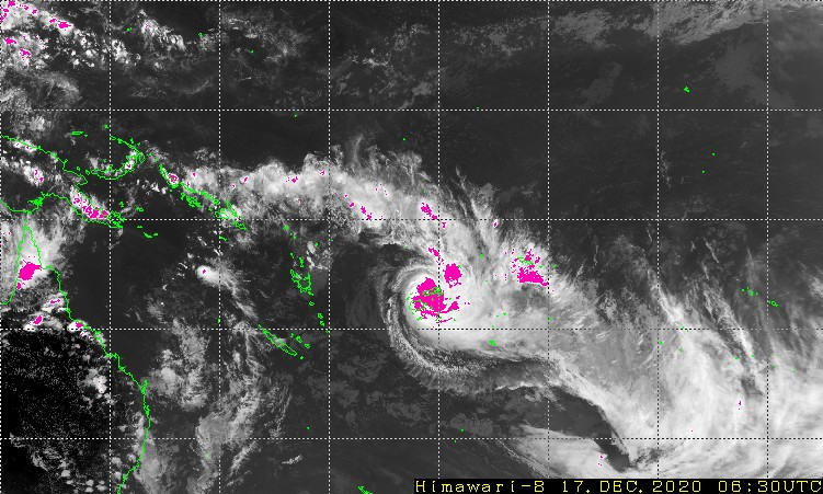
Severe (Category 5) Tropical Cyclone YASA could ruin Christmas for many in Fiji. At 170600UTC the system was some 99nm NNE of Suva, Vili Levu island moving SE at 12 knots crossing the western end of Vanua Levu Island with winds of 130 knots and gusts to 160 knots.
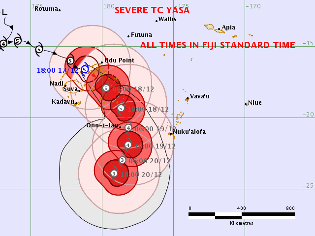
Numerical guidance is good over the next 24-36 hrs with the system tracking SE over the Koro Sea before starting to weaken, slow down and track more southward. Thereafter there remains considerable uncertainty with the models split over the exact track for now. The ECWMF model takes it east and south of Tonga by 21 Dec while the GFS model takes it rapidly west. These differences result in a spread of 620nm at T+120 hrs (22 Dec) which is problematic for forecasters.

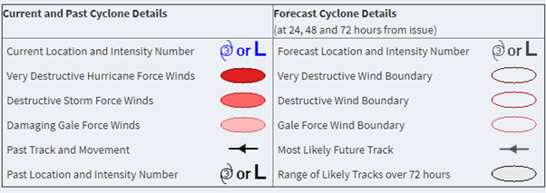
This is the latest forecast issued by the Regional Specialised Meteorological Centre (RSMC) Nadi, Fiji at 0722 UTC this morning showing a consensus track for the next 36 hours then opting for a more westerly track thereafter, so favouring the GFS solution for now.


This comes after a similar strength system, TC Harold, caused widespread destruction across the Solomon Islands, Vanuata, Fiji and Tonga during April earlier this year. Harold was the first Cat 5 tropical cyclone in 2020.
Since then the North Atlantic hurricane season has set all new time records for that region. It is now the turn of the SW Pacific region with the Australian Bureau of Meteorology predicting an above average season, mainly due to the strong La Nina. Watch this space for updates and our thoughts are for the safety of all mariners at sea and the communities on land impacted by these severe weather events.
And all this on top of Covid-19.
Stay connected and safe.