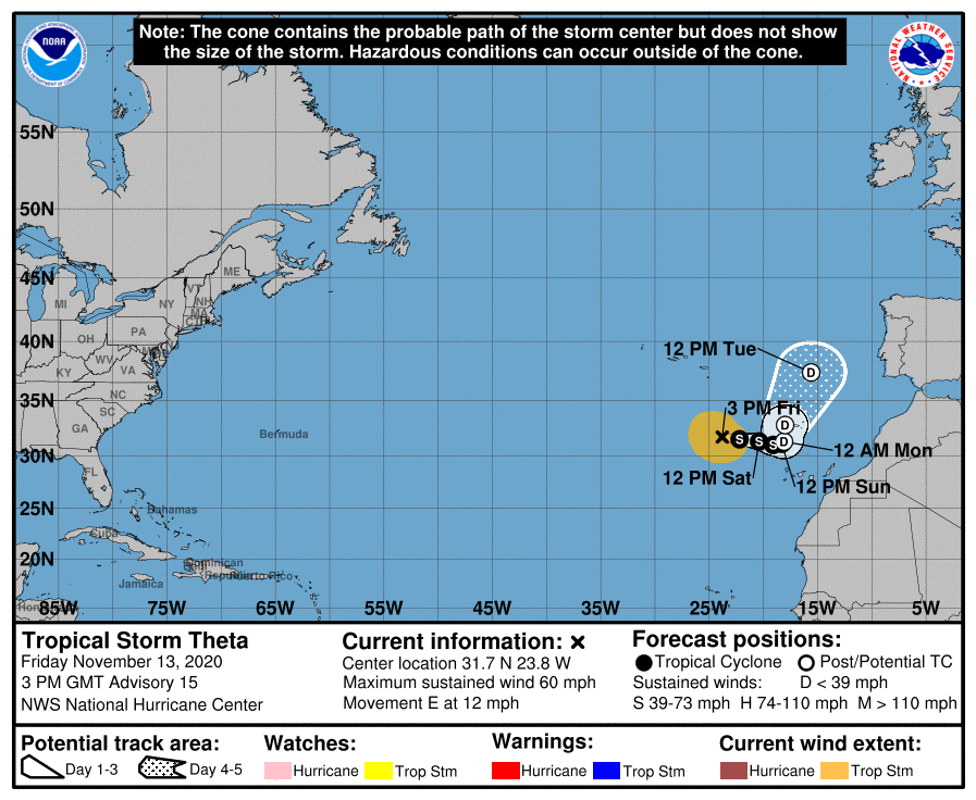
Sub-Tropical Storm Theta formed last Monday night to become the 29th named storm of the season. This broke the season record for the most named storms, held by 2005 according to the WMO. The system is sub-Tropical because of the latitude, but it has tropical characteristics. We suggested at the start of the season that this could be a record breaking year and so it has proven to be. Within the 29 named storms. there have been 12 hurricanes and 5 intense hurricanes compared with an average of 11.2, 5.9 and 2.6 respectively according to Colorado State University. Theta is expected to peak at around 55 KT over the next 24 hrs before declining and move NE in between the Azores and Canary islands as indicated by this NHS image.

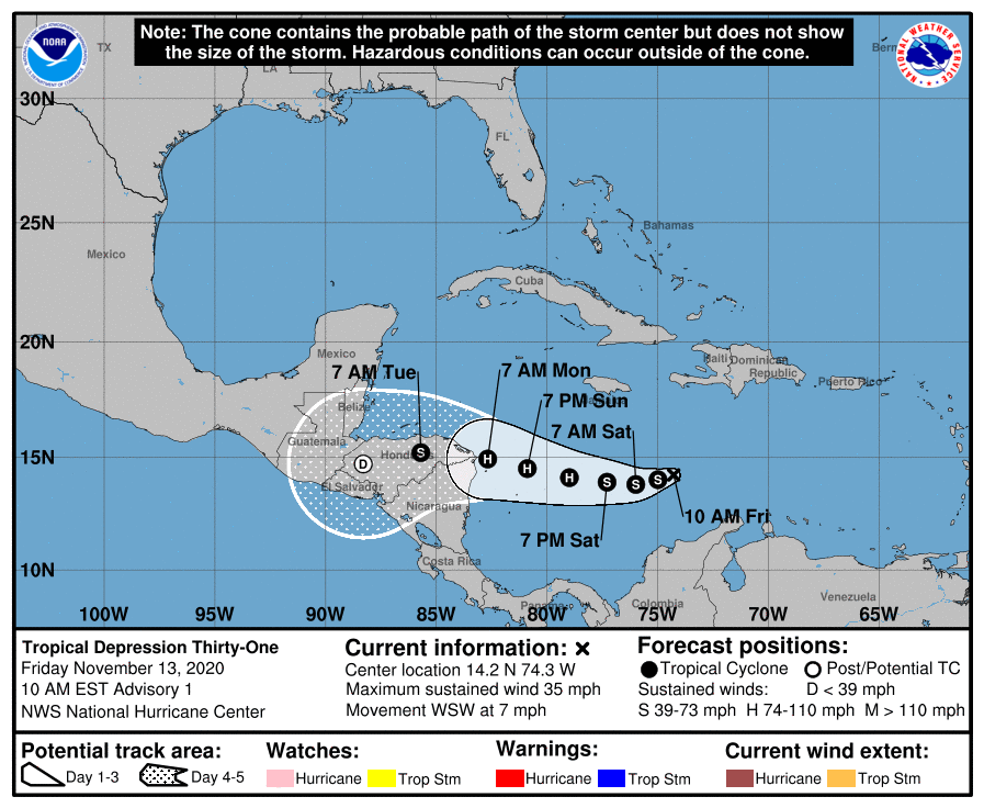
Meanwhile, NHC has also observed Tropical Depression 31, which looks set to become the 30th named storm ‘Lota’ (and the 9th Greek Alphabet letter) which is expected to intensify as it moves westwards to reach hurricane strength over the weekend,impacting Nicaragua and Honduras early next week.

As the Atlantic hurricane season normally runs 1 June to 30 November, there is still time to set an even higher record, noting that some of the naming of systems has been somewhat curious this year and would not necessarily have been named in previous years – a discussion for a later blog.
Northeast Pacific
This region has had a slightly below average season so far with 15 named storms, 4 hurricanes and 3 major hurricanes. This is despite it had the earliest start to any season east of 140W on record with TD one-E on 25th April. The NHC, Miami are currently monitoring an area of low pressure several hundred miles off SW Mexico which lies in an area conducive for gradual development with a 60% chance of developing in to a cyclone over the next five days.

Northwest Pacific
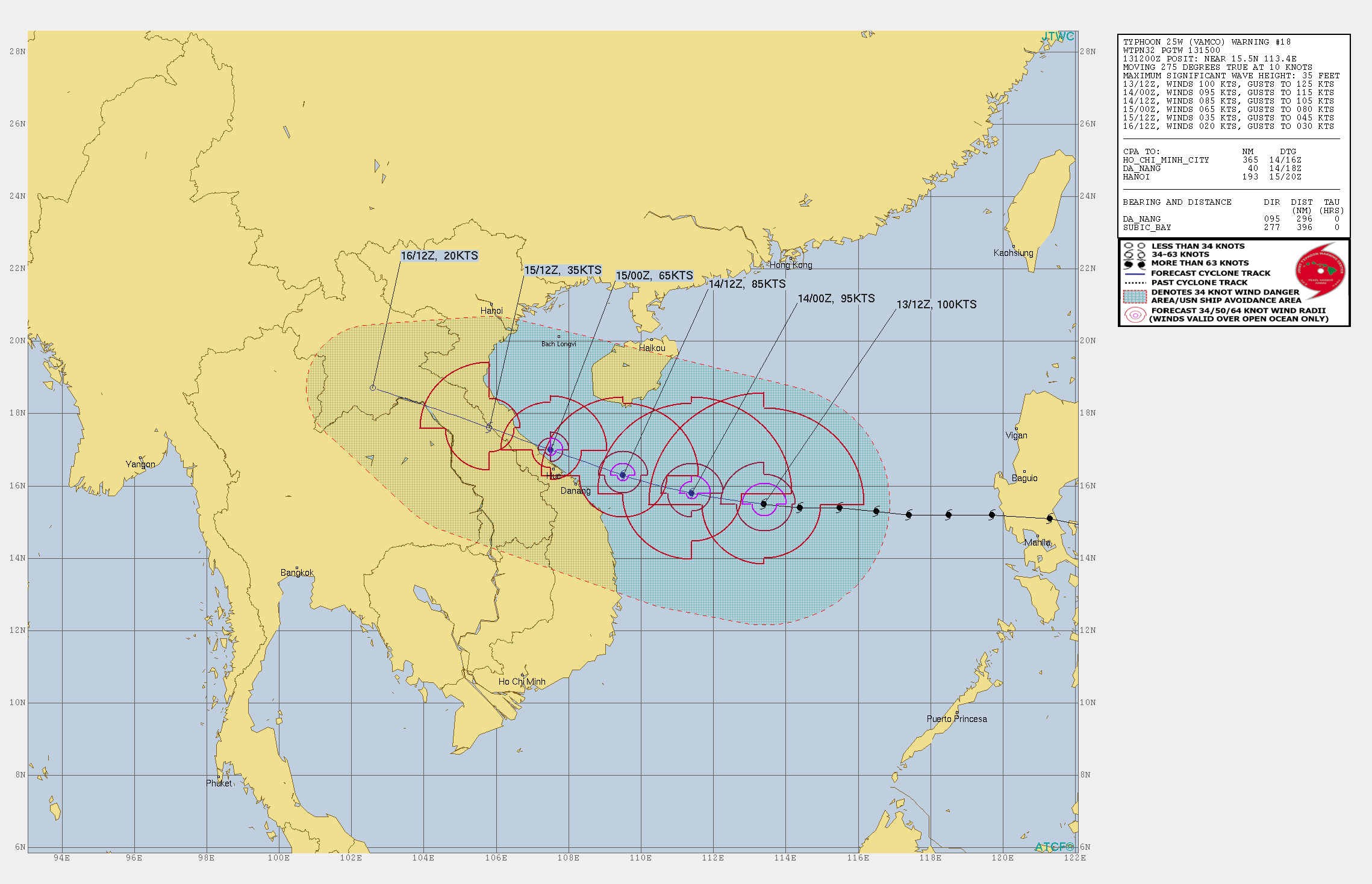
After an unusually inactive first half of the season, which marked the 5th latest start since records began, the NW Pacific has been playing catch up. There is currently Typhoon

Vamco over the central South China Seas which is moving west and is expected to weaken further before it goes ashore across central Vietnam on Sunday 15 Nov.
Indian Ocean
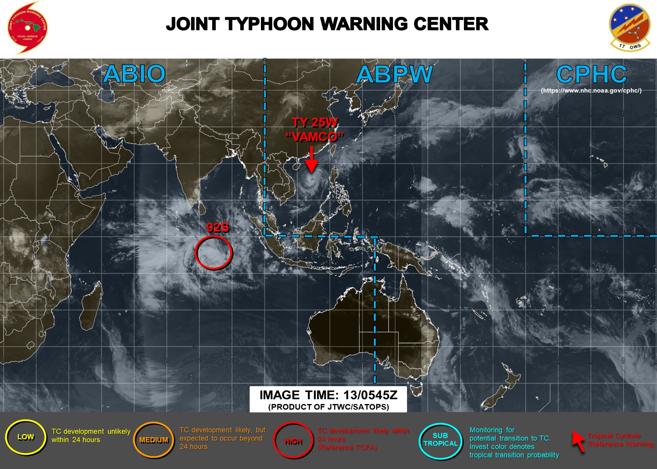
The Tropical Cyclone Centre, La Reunion is also monitoring Tropical Depression 1 located near 6S 83E at 12000 UTC today (indicated as 92S in this JTWC image) which is expected to move SW and intensify and pass some 150-200nm south of Diego Garcia over the weekend.

Meanwhile, it remains quiet over the Australasia region with the Australian BOM predicting an above average season. The record rests with 2005 so watch this space to see if this region performs like the Atlantic has for 2020!
Stay connected and safe.